The bulk of the research I have completed on this subject was collected some years ago for my own personal benefit and I never envisioned that I would be presenting it for general consumption, so some of the sources quoted may be outdated, for which I apologise in advance.
The Arthurian Legend is universal and international. He even crops up in Japanese culture as the legendary ‘Yamato-takeru’. The Ossetians of the north-central Caucasus preserve a corpus of legends about an Arthurian-type hero called ‘Batraz’. The British tradition is usually considered to be the definitive source – especially by the British, but he can also be found in the French, Danish, Spanish, Italian and Norwegian ones. For me this points to a common, ancient source that has probably been obscured and mutilated.
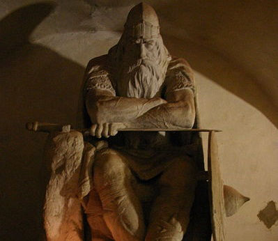
Holger Danske (Ogier le Dane) sits under Kronborg Castle ready to rescue Denmark in its next hour of need Source
It isn’t my intention to get into a debate about Arthur’s authenticity or identity, the horse has already bolted on that issue, in my opinion and by now the waters are so muddy it’s impossible to catch even a glimpse of the bottom.
As this article is long, I have written a ‘Contents’ with brief descriptions so as to save anyone the trouble of reading the whole thing before discovering they weren’t interested...
The oldest surviving works on Arthur comprise:
These are the books that have been allowed to survive because they depict an image of Arthur that is suitable for public consumption – a fairy-tale heroic champion and crusader of the Christian faith. The lost books are the ones that have been hunted down and destroyed because they don’t fit with the official line. These are precisely the books that are far more likely to contain the truth.
The main pivot of this ‘tale’ rests on two different books. Both of which are ‘lost’:
‘Inventio Fortunata’ (The Blessed Discovery)
‘Gestis Arthuri ’ (The Deeds of Arthur)
Despite its title, the Inventio Fortunata isn’t a Harry Potter spellbook. All we have left of these two books are references to them. The most prominent of these are from our old 16th century friends, Dr. John Dee, Gerardus Mercator and his map-making pals, plus a certain Jacobus Cnoyen of Hertogenbosch (in present-day Netherlands). He summarised the Inventio Fortunata as it was related to him in 1364 in Norway by a Franciscan monk who had met the author. Cnoyen’s own travel-book was called the ‘Itinerarium’, but guess what, this book has also been lost, or rather suppressed.
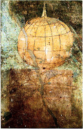
AD 50 ‘Roman’ fresco depiction of a globe with a north pole mountain, just like later magnetic mountain maps. Found in the Boscoreale villa near Pompeii. Size of original 61 x 39.7 cm. Metropolitan Museum of Art, Rogers Fund 1903. It is less known because it was originally misinterpreted as a sundial. But "This detail clearly shows a globe drawn in approximate perspective."
(Woodward & Harley, The History of Cartography, Vol 1, 1987) Source
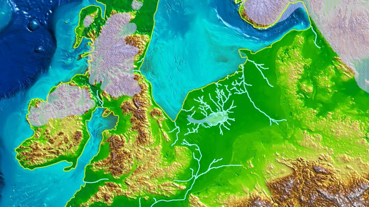
The Inventio Fortunata described a very different topography for the Arctic Circle to that which we have been told exists today and was the authoritative basis for mainstream maps, globes and atlas’ for more than 150 years when that particular configuration of land around the North Pole was censored from the public’s awareness by simply and literally erasing it from the maps.
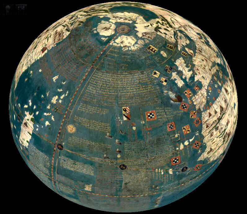
Martin Behaim’s globe of 1492 Source
Martin Behaim’s globe of 1492 was the first ever to be centered on the North Pole itself and shows a series of islands encircling it. Two larger islands are depicted right near the Pole in the western hemisphere, while extensions of Europe and Asia reach northwards. Together they form a broken circle of land around the Pole.
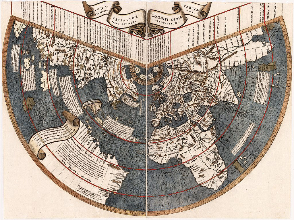
Detail from Johannes Ruysch's 1507 world map. Ruysch had different ideas regarding the rivers and islands to those of Mercator. There are no Pygmies as we will encounter later on Mercator's map, but two of the islands feature legendary tribes from Herodotus, (a Greek writer and geographer of the 5th century BC credited with being the first historian.) Source
A world map by Johannes Ruysch, the Universalior cogniti orbis tabula, published in an edition of Ptolemy’s Geographia in Rome in 1508, actually mentions the Inventio Fortunata and shows the same four islands around the North Pole; two are labeled “Insula Deserta”; the one north of Europe is that of the Hyperboreans; and the one north of America is labeled “Aronphei.” He labels the waters within the four islands as the “Mare Sugenum,” and speaks of a violent whirlpool that sucks the incoming waters down into the earth; in addition, his map shows a ring of small, very mountainous islands around the four main islands, which Ruysch says are uninhabited. A high magnetic rock at the Arctic Pole is also described.
There are many, many other contemporary maps –literally scores, including examples from as late as the 1700's, that show the same configuration of islands around the Pole. There are even Chinese maps that show the northern islands (e.g. Shanhai Yudi Quantu, Complete Geographic Map of the Mountains and Seas, 1609). These Chinese maps are derived from the world maps of the Jesuit missionary Matteo Ricci (1552-1610.) Mercator-influenced maps also appear in Japan: Abe Yasuyuki’s Banukoku Chikyu Yochi Zenzu or Map of the World (1853), shows the four northern islands.
The most famous Inventio Fortunata inspired map is Mercator’s 1569 World Map with its Polar Insert. Map collectors have been saying for decades that this map contains details such as the island in the Hudson Bay and the two major rivers that feed into it, that were unknown to other cartographers and didn’t appear on maps until the 19th century, 300 years later.

The 1569 Mercator map of the world Source

Mercator's Polar Insert, 1606 version Source
The image above is of the 1606 version as the resolution is much higher enabling the text to be read.
The island on the bottom right is labelled: “Here live pygmies no more than 4 feet tall like those in Greenland that are called ‘Skraelinger’”.
Upper left, describes 4 rivers with 19 openings to the ocean, All flow north and empty into the central sea then pass to the inner earth through a 33 league (114 mile/183 km) wide canyon below the mountain.
Lower left, “healthiest and most fabulous island in the North”.
Top right identifies the islands as the Bargu (Bargos) islands. A later version claims that they rotate around the pole and that compass needles always point south. On the back of the later version it states that when navigating in the Bargos Islands all compass directions must be reversed. Also mentions the six months of darkness and daylight, the aurora borealis, the sound of bells in the far north and the ‘Monochar Order’.
The island to the north of Pygmy-land is labelled: “This narrow channel has a harbor and due to its narrowness and swift current never freezes.”
On the 20 April 1577, Gerardus Mercator replied to a letter from John Dee which Dee later published in a manuscript entitled "Volume of Great and Rich Discoveries". Dee was questioning Mercator with regard to the provenance of the Polar insert on his 1569 Arctic map. Mercator had borrowed Cnoyen’s ‘Itinerarium’ from a friend and detailed all of his notes from it to Dee in the letter. Unfortunately Dee’s manuscript has been badly damaged by fire, but enough remains to gain a very good idea of the Inventio Fortunata’s contents. A transcript of the letter is available here.
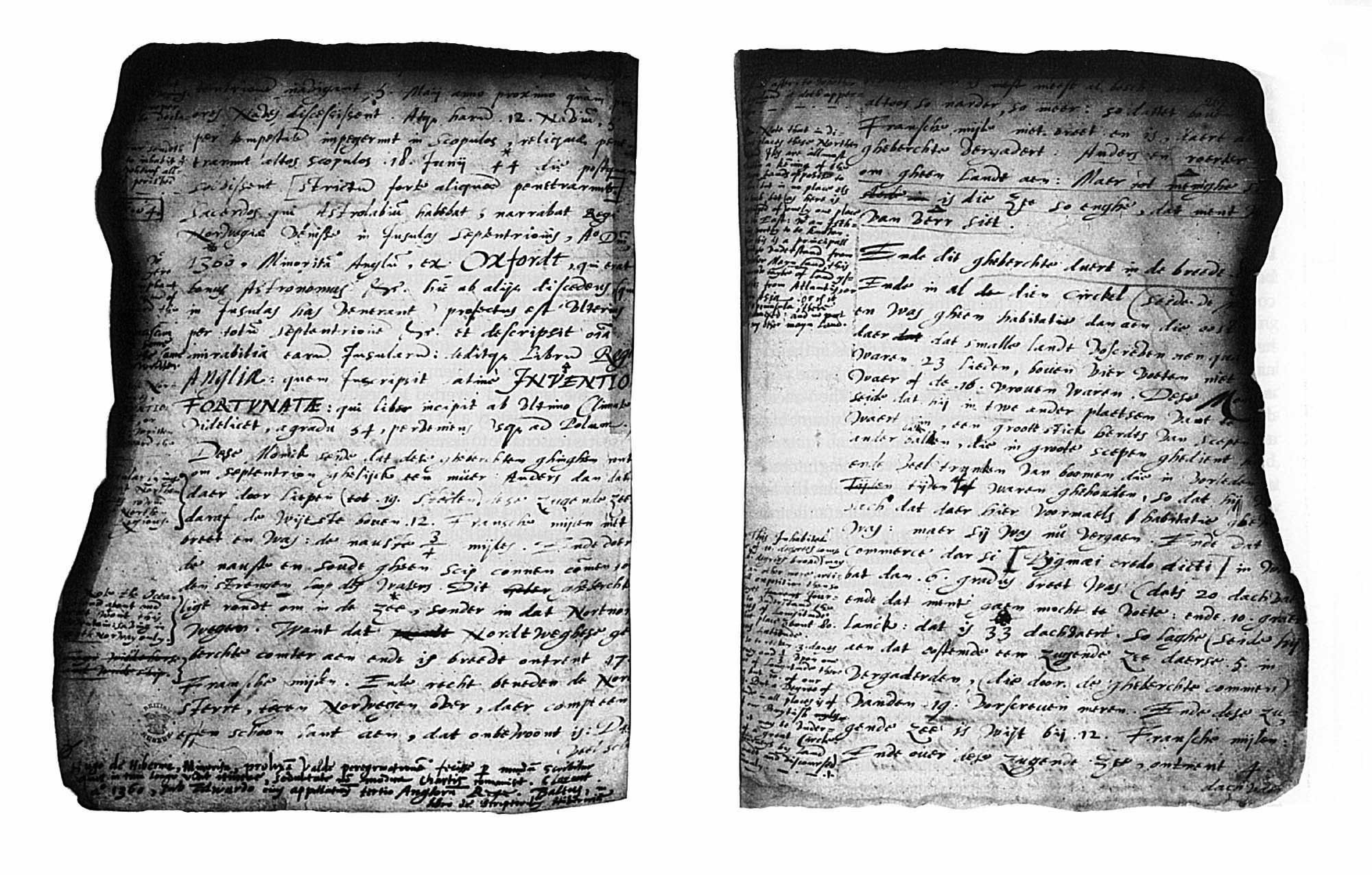
Mercator’s letter of 1577 Source
Around 1577 or 1578 John Dee wrote a book entitled "Brytanici Imperii Limites" (The Limits of the British Empire), which is a compilation of four documents originally written for Queen Elizabeth I and assembled under his supervision in 1593, then placed in the Crown’s Archives. It was only rediscovered in 1976, and is now in the British Library.
To establish some frame of reference for the original documents’ time period, London was full of interest in the ‘New World’ and Martin Frobisher had returned from his first voyage to what is now Baffin Island, Canada. Sir Humphrey Gilbert was applying for his letters patent to colonize all of North America north of Florida. England was desperately looking for ways to discredit the Spanish claim to America.
In his Brytanici Imperii Limites, Dee argued that because King Arthur had once extended his kingdom to include Ireland, Greenland, Iceland and parts of the North Pole, so too might Queen Elizabeth I. He also argued that England should lay claim to new lands through colonisation and that this could be achieved through maritime supremacy. He also included ‘Atlantis’ in his list of acquisitions, but everyone will tell you what he really meant was ‘America’, even though everyone else seemed to be calling it Terra Florida at the time.
It would be easy to discount this concept as the ravings of madman who was basing such a wild claim on nothing more than a fantasy and who was simply trying to gain favour with the Queen, but he had proof and he wasn’t the first to associate Arthur with northern conquests.
King Arthur Source
“Note the Colonies sent by King Arthur into all the north Islands and by name into Grocland, which I yet suppose to be the same which is otherwise anciently known as Groenland [i.e., Greenland] and of that you had the word before owt of the boke De Priscus Anglorum Legibus” (Dee assumes that Grocland is Greenland based soley upon the shared ‘Gr’. However, on Mercator's globe Grocland lies west of Greenland and may be a representation of the Arctic Baffin Island.)
The source he refers to was William Lambarde's Archaionomia sive de Priscus Anglorum Legibus libri (1568), which Dee had a copy of in his famous library. This same source was also known to Richard Hakluyt, another proponent of an Arthurian Atlantic and Arctic empire, who would translate it later in his ‘Principal Nauigations’ (1599):
“Arthur which was sometimes the most renowned king of the Britains, was a mightie, and valiant man, and a famous warriour. This kingdome was too litle for him, & his minde was not contented with it. He therefore valiantly subdued all Scantia, which is now called Norway, and all the Islands beyond Norway, to wit, Island [i.e., Iceland] and Greenland, which are apperteining vnto Norway, Sweueland, Ireland, Gotland, Denmarke, Semeland, Windland [Latin text, Winlandiam], Curland, Roe, Femeland [i.e., Finland], Wireland, Flanders, Cherilland, Lapland, and all the other lands & Islands of the East sea, euen vnto Russia* (in which Lapland he placed the Easterly bounds of his Brittish Empire) and many other Islands beyond Norway, euen vnder the North pole, which are appendances of Scantia, now called Norway.”
[*It's interesting to see the name 'Russia' being used at this early date (1573.)]
William Lambarde himself had a very clear source for the text he gave in his Priscus Anglorum Legibus - a manuscript of the Leges Edwardi Confessoris that contained an Arthurian section taken from the Leges Anglorum Londoniis Collectae, from c. 1210. (I hope you’re following this because I’m not sure I do…) The tradition of Arthur as an Arctic conqueror must certainly go back to at least the very early thirteenth century.
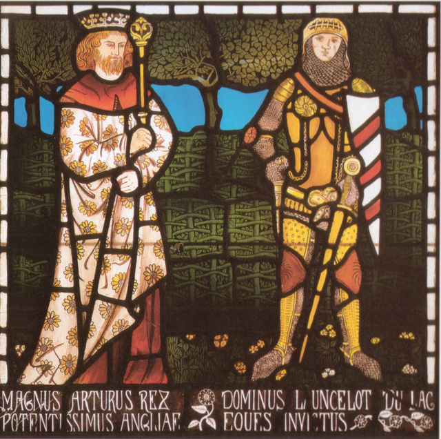
King Arthur and Lancelot Source
Even older evidence comes from a fragment of a text known as Insule Britannie, c.1199. Whilst it makes no mention of Arthur by name, it lists a number of northern islands as being "British" possessions, all but one of which are also named (in similar spellings) as constituent parts of Arthur's British Empire in the Leges Anglorum. This would indicate that there was an even earlier source than the Leges and the Insule Britannie, now ‘lost’. It’s unlikely that they are simply elaborations of Geoffrey of Monmouth's Historia Regum Britanniae, given their very different concept of Arthur. Similarly, Geoffrey of Monmouth’s source, the Historia Brittonum c.828, with its ‘dux bellorum’ or military leader, bears no relation to the King Arthur of the Leges and the Insule Britannie. It is highly likely that the lost source is the Gestae Arthuri. Both the Leges Anglorum and the Insule Britannie are sanitised versions of it with falsified incorporations from Adam of Bremen's Gesta Hammaburgensis Ecclesia Pontificum of c. 1075, whereby the account of the Christian conversion of Norway (begun by John, an English bishop, and spread by Olaf, king of Norway), was transferred to Arthur.
Eirik the Red is also claimed to have discovered and subjugated Greenland and Vinland in the ninth or tenth century. These Norse sagas reported in detail the discovery voyages of Iceland, Greenland and Vinland. However and very importantly, the Gestae Arthuri has the knowledge of these lands as a precondition – there is no discovery required. Also, if the Gestae Arthuri is simply transferring the Norse tales to Arthur, why do the Norse sagas never mention the Hyperborea region at all? Besides, the Gestae Arthuri may even predate Eirik the Red’s adventures. Also “when the Norse first landed on Iceland, they found it inhabited by a British people that they termed the “Pappar”, whom they promptly drove extinct.” Good luck trying to find any decent information on these Pappars. (Source)
“Dee went to some pains to legitimize his Arthurian material, complaining that the profusion of "fables, glosinges, vntruthes, and impossibilities, incerted in the true historie of King Arthure" meant that the "truth yt selfe" of Arthur's historical acts, as Dee conceived it, was often disbelieved or ignored, and can only be retrieved through a purging of the parasitic legends that had gathered around it... Having weeded out the "untruths" from the Arthurian narratives he had gathered, Dee could confidently proclaim that Arthur had conquered Gaul, Scandinavia, Iceland, Greenland, all the northern islands around Russia (i.e., the entire Arctic Ocean abutting northern Europe, Estotiland—which may be the Canadian Baffin Island, if it describes a real place), as well as the North Pole itself.” Source
In his Brytanici Imperii Limites Dee states that there once were many proofs of Arthur's conquests, but "willfully and wickedlie (as by sondrie credible gentlemen I have heard it testefied), this Polijdor [Polydore Vergil] burnt [them], yea a whole carte load almost"
Dee's concept of Arthur as a North Atlantic and Arctic conqueror doesn’t appear to have been his own invention.
What follows is Dee's account of a King Arthur that doesn’t equate with any character of romantic fiction…
In northern Norway (which is also called dark Norway [because] it is dark three months on end, the sun never rising above the horizon) there is sometimes a sort of dawn ... The passage to North Norway is not easy because of the fast flowing seas which flow past Grocland … This North Norway stretches to those mountains which surround the North Pole in a circular course. These are the mountains of which it is written that they were among them certain cities, as you can find mentioned in the Arthuri Gestis, and over against them dwell people of small stature, mentioned in the same work. These things, and more besides, concerning the northern regions can be found at the beginning of the Arthuri Gestis. Long ago the islands lying in the North were called the Ciliae, now the Septentrionals, and among them were North Norway and many small rivers which are called the Indrawing Seas because their waters are pulled towards the North with a great constant force, such that no wind can drive a ship against them. And in this attitude there are very high mountains reaching to the clouds, and in this attitude the air is very often murky and dark.
In the 78th degree of latitude (like a crown or circlet) there stand around the North Pole immensely high mountains over most of the land, but in some places there are reports that these Indrawing Seas, [are] in some places up to 50, 60, or 100 leagues across (some broader but others narrower) which everywhere pull to the North. One group of Arthur’s knights sailed thus far when he was conquering the Northern Isles and making them all subject to him. And in the writings of the ancients it is stated that these Indrawing seas snatched from Arthur some 4000 men who never returned, but [that], in 1364 eight of the descendants of these men returned to the King of Norway, and among them were two priests, one of whom had an astrolabe, and he was descended by five generations from [a man named] Bruxellensis, who … was in one of the first ships to penetrate those northern regions.
That Great Army of Arthur had lain all the winter (of 530 AD) in the northern islands of Scotland. And on May the 3rd a part of it crossed over into Iceland. Then four ships of the aforesaid land had come out of the north and warned Arthur of the indrawing seas. Arthur did not proceed further but peopled all the islands between Scotland and Iceland, and also peopled Grocland, where he found people 23 feet tall. When those four ships returned there were sailors who asserted they knew where the magnetic lands were.
On May the 3rd the following year Arthur then sent 12 ships with 1800 men and 400 women northwards. Of these 12 ships, five were driven onto the rocks in a storm but the rest made their way between the high rocks on June 18, forty-four days after they had set out.” (Please note: seven ships made land.)
“The priest who had the astrolabe told the King of Norway that there had come to the Northern Isles in 1360 an English Minorite from Oxford, who was a good astronomer. He, leaving the others who had come to these islands, set off further throughout all the northern regions and put into writing all their wonders, and gave the resulting book, which he called Inventio Fortunae, to the King of England. This book begins from the furthest clime, from 54°, and continues all the way to the Poles. This Franciscan reported that these mountains surround the Pole without a break except in those places where the Indrawing seas break through.”
Some things not mentioned by Dee that were included in Mercator’s letter are:
To summarise: Here we have King Arthur on an expedition to specifically penetrate the circular mountain range surrounding the North Pole, where there are cities. Five generations later, eight descendants of Arthur’s men returned to Norway. Two of the eight were priests. One of the priests states that four years earlier a group of people visited them in the Northern Isles, one of whom was an English Minorite Monk from Oxford who was a good astronomer and had swapped his astrolabe with this priest for a “Testament”. This monk then set off on his own to explore the northern regions. He described all the wonders of the islands in a book that he called the Inventio Fortunata and at some point gave it to the King of England who then sent the monk to do monkey-business on his behalf five times.
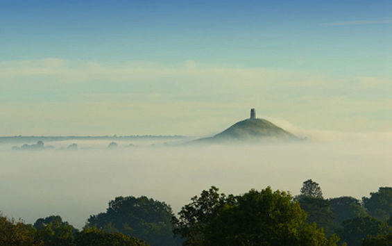
Arctic symbolism in Glastonbury, UK Source
This is a poem from The Book of Taliesin that was first written down in the ninth century, but has been shown to date from the sixth century. In this poem Arthur and his heroes journey through wild waters to a strange and frozen land to rescue Gweir and to find a cauldron.
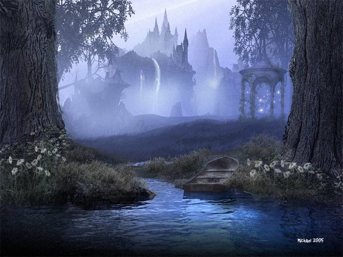
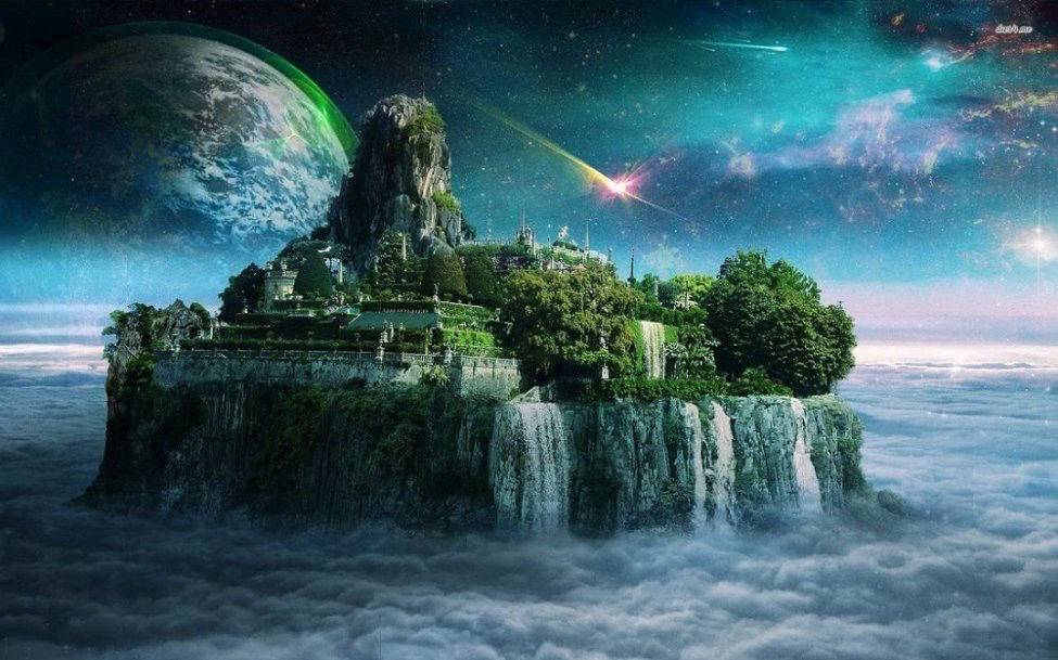
The title, 'Preiddeu Annwfn', means ‘The Raid on Annwfn’, although most scholars translate it as ‘The Spoils of Annwfn’. The Avalon of later Arthurian legends was known as Annwn or Annwfn to the earlier Celts. The word is traditionally translated "otherworld." Alternative translations are "un-world," "very-deep," and "extreme world." It’s a place that you can sail to by ship and also a place you can rule over or rather be a guardian of – given the right circumstances. It is not a Celtic "underworld," per se and has only been associated with Hell due to later Christian influences. Within the context of this article, I am taking it as another reference to the ‘Hyperborean’ region at the North Pole.
Annwfn is generally associated with hills mountains and islands. In the poem we are told that it’s a series of islands to which King Arthur and his men journey in search of a magic cauldron and to free Gweir from his imprisonment in chains. Although the poem mentions eight different caers (fortresses or castles), most ‘scholars’ insist that the action takes place in one location with eight different names. This is due to the insistence that this one location is Lundy, a small island off the coast of Cornwall in the Bristol Channel. In Welsh it is known as Ynys Weir or Wair, "Gweir's Island”. However, this would make sense if it was called Gweir’s Prison rather than his Island, but what makes even more sense is that Gweir is the name of the celtic sun god and no doubt from some point it probably looks like the sun sets on the island at a certain time of year. (Update 2022: This association of Gweir with a Celtic sun-god is based solely upon one unreliable source and is unlikely.)
So, in the poem Gweir has been imprisoned within Caer Sidi (Mound Fortress or Fortress of the fairy-folk ,) where he is bound in chains and ‘singing woefully’ before the treasure or spoils of Annvn, which also seem to be imprisoned along with him. This situation is due to the actions of Pwyll and Pryderi. In a tale from the First Branch of The Mabinogi, Pwyll exchanges place and shape with Arawn, who is the king of Annwn. Pryderi was Pwyll’s son, who through some foolishness plunged the land (Dyfed) into chaos turning it into a wasteland where all the people and livestock disappeared in mist, except for his closest relatives. So, by all accounts, Pryderi was a bit of a disaster and his father had also been up to no good when he obtained his mother Rhiannon’s hand in marriage by deception and murder. It’s no surprise then that these two had done something to cause the imprisonment of the sun god, Gweir and the treasures of Annwn.
Update 2022: There is no mention in the poem that Gweir is ever released by Arthur. The problems of Pwyll and Pryderi involved Gwydion - a generally bad lot. Gweir's Island was also known as Gwydion's Island, so the names may be interchangeable. It could be that Gwydion was placed in chains for trying to steal the Cauldron of Life - especially as he had a reputation for stealing cauldrons.
At the end of each verse in the poem there is a repetition of the same information whereby we are told that three shiploads of ‘Prydwen’ (Arthur’s ship) set sail or went into the fortresses, but only seven returned. As a unit of measure a ‘Prydwen’ is not of much use to us these days. Perhaps there is something lost in translation and maybe a ‘shipload of Prydwen’ is simply a squadron of ships of which seven ships returned. If we take it at face value, then it seems ludicrous that Arthur had just one ship and had to make three separate journeys to ferry his men to their destination.
The second verse speaks of Caer Pedryvan or the Four-Peaked Fortress, ‘four its revolutions’, in the Isle of The Strong Door. This is reminiscent of Mercator’s Polar Insert: “Top right identifies the islands as the Bargu (Bargos) islands. A later version claims that they rotate around the pole”. The verse goes on to discuss the Cauldron of the Ruler of Annwn.
In Celtic lore the cauldron is the symbol of the Otherworld in that it symbolises the womb of the Great Goddess whereby everything is born out of it and returns to it. It is also a symbol of rebirth, the hearth, of abundance and of well being. Ancient Celtic tales tell of cauldrons that no one ever went away from hungry and cauldrons that, when the dead were thrown into them, would bring the them back to life. The cauldron is common to many Celtic stories and they are described as great treasures with magical powers.
In the Celtic tradition, Bran is one of the father-figure gods and a giant. It is told that when he lay down over a river, an army could march across him. He is also king of the otherworld/underworld (i.e. the ruler of Annwn), and watches over the treasures of ‘Don’, the Mother Goddess (Danu in the Irish tradition). These treasures are the animals, plants, insects, birds and the fabric of life itself of the Earth. So Bran is a king in the Celtic sense in that he was guardian to and of the goddess. He is also the god of Bards. Bran is associated with Avalon/Annvn, and one of the places his head is said to be buried is there.
What’s intended by showing that the cauldron of the Ruler of Annvn is imprisoned is that the fabric of life itself - the treasures of the Mother goddess – are no longer under the guardian’s control.
The cauldron of the guardian of Annwn is described as being the same one from which the first word was spoken (i.e.creation) when it was gently warmed by the breath of nine maidens.
‘The Nine Maidens’ is another universal symbol and can be found in many cultures. For example, the Greek tale in which the nine Muses gave inspiration to humans. They are generally known as being island dwellers. The poet Taliesin himself was gifted by the nine maidens when three drops of ‘the life force’ or ‘inspiration’ accidentally fell on his hand as he was stirring their cauldron. In modern Arthurian material, the best known of these groups are the Nine Sorceresses, Morgan and her sisters, who live on the Isle of Avalon and are both seeresses and healers.
Pomponius Mela (c.43 AD) makes mention of a group of nine sorceresses or holy women who were known to inhabit an island in the west. “In the Brittanic Sea, opposite the coast of the Ossismi, the isle of Sena (Sein) belongs to a Gallic divinity and is famous for its oracle, whose priestesses, sanctified by perpetual virginity are reportedly nine in number” He further says “They call the priestesses Gallisenae and think that because they have been endowed with unique powers, they stir up the seas and winds by their magic charms, that they turn into whatever animals they want, that they cure what is incurable among other peoples, that they know and predict the future, but that it is not revealed except to sea-voyagers and then only to those travelling to consult them.” In the Celtic tradition animals bridge the natural and supernatural worlds, acting as a connection which allows shape-shifting and accounts for ‘familiars’.
In the poem there then follows a difficult section that nobody understands very well. It seems that the cauldron was recovered by means of a magical sword and left in the hands of ‘Leminawc’, who may be Arthur himself. As a result of this the lamps leading the way to the gates of hell were lit. Caer Vedwyd (Castle of the Perfect Ones) is mentioned. Undaunted, they fight on to the next verse.
Overcoming a jet black turbulent sea, they reach Caer Rigor (Frozen Castle, Fortress of Hardness). Next up is Caer Wydyr (The Glass Fortress) where either six thousand or sixty men stood upon the walls and they were difficult to communicate with. Caer Golud (Fortress of Hindrance) is also mentioned.
Verses five and six are difficult. Taliesin seems to be ‘ranting’ against ignorance. There is mention of Caer Vandwy (Castle on High, Fortress of God's Peak) and Caer Ochren (Castle of Shelving Sides [entered from a slope], Fortress of Enclosedness [not a real word]).
The final verse is quite clearly a rant against monks who learn only by rote from their superiors, who in turn know nothing of the real world. The poem ends with the enigmatic phrase “crist am gwadawl”, which probably either means ‘Christ be my saviour’ or ‘Christ be my follower’. Personally I think he meant the latter if he wrote it at all and it wasn't a later addition by some monk or scribe.
Coincidentally, on the subject of monks, the 'Navigation of St. Brendan' is one of the most proliferate of surviving medieval texts, although this character was supposedly concurrent with Taliesin. Ostensibly, it’s the tale of the abbot, St. Brendan, it tells of his adventures with a crew of monks exploring the isle of promise (Avalon/Annwn) in that mysterious Celtic Otherworld reached over western seas. It's hard to overestimate its popularity over the years. There are at least 116 surviving Latin manuscripts as well as versions in Middle English, German, French, Italian, Flemish, Norse and Provencal. [Please note: The Book of Taliesin never got such a wide circulation.]
St. Brendan was born around the end of the 5th Century in Clonfert, France, where he also died. His ashes were buried in Notre-Dame-d’Aynès. The book’s first draft is claimed to be between the 7th and the 8th centuries. It describes a seven year voyage to ‘Paradise’ full of events and strange encounters: Island by high cliffs, Island of the giant sheep, the great whale, the Paradise of Birds, the elders of the community of Saint Albeo, Island of blacksmiths (the Hell), Judas Iscariot, the hermit Paul (episodes where one can find similarities with Imram, the Apocalypse or medieval texts describing voyages to the Holy Land, or even with the Aeneid, the Odyssey or Germanic mythology)… Chapters 36 and 37 again describe the Island of the Blessed, while chapter 38 tells of the return home and the serene death of the Saint. Source
There is little doubt that the ‘Navigation of St. Brendan' is catholic propaganda and 99% fiction. However, could it include some information from the Inventio Fortunata? As we shall see, there is evidence to suggest that it does.
Sources for the above:
Annwfn
Cauldron
Cauldron - The Witchipedia
The Nine Maidens
Navigation of St. Brendan, from Lundy Isle of Avalon by Mystic Realms
Perlesvaus is said to be a continuation of Chrétien de Troyes' unfinished Perceval, the Story of the Grail. The anonymous author of the story claims that the original Latin text was taken from the Isle of Avalon, from a holy religious house which stands at the head of the Lands Adventurous, where lies King Arthur and his Queen, by the testimony of the worthy religious men who dwell there, and who have the whole story, true from beginning to end. The Isle of Avalon is also referred to as The Fortunate Isle (Isla Fortunata). So, could Inventio Fortunata also mean the Discovery of Avalon?
Dee was convinced that the “English Minorite from Oxford” was Hugo of Ireland, an adventurer and author from c.1360, about whom absolutely nothing is known. A certain Nicholas of Lynne has also been put forward as the favourite, but he was a Caramelite, not a Minorite, which was the wrong flavour altogether. More recently some historians suggested that the priest who reported to the king of Norway in 1364 was Ivar Bardsson. England was fairly well connected with Norway at the time through the trading activities of the Hanseatic League.
The claim that eight people from Arthur’s Hyperborean colony visited Norway in 1364 and that they were the 5th generation descendants of the original settlers doesn’t make any sense. Even John Dee noted this in his handwritten notes in the margin of Mercator’s letter:
“fortè.[maybe] 25 gradu. [generations] I mean in the 25 generation, at the least, after King Arthur, his tyme allowing longer Ages, than now the generall rate is at: betwene 25 & 30 yeres to a generation.”
5 generations after 530 AD is about 680 AD, so the 1360 dates don’t work. Dee questions the number of generations rather than the 14th century dates and even seems to think that people lived longer in Arthur’s time. These dates come from Jacobus Cnoyen via Mercator who was able to study Cnoyen’s book, Itinerarium and seems to have been one of the last people to do so before it vanished from the face of the earth, along with any other information about its author. Cnoyen’s English Minorite Monk from Oxford had his entire adventure between 1360 and 1364 – just 4 years.
“The Order of Friars Minor, previously known as the "Observant" branch… The latter two, the Capuchin and Conventual, remain distinct religious institutes within the Catholic Church, observing the Rule of Saint Francis with different emphases. Conventual Franciscans are sometimes referred to as minorites or greyfriars because of their habit... Source
Nine Franciscans turned up in Oxford (the intellectual capital of England) around 1224. “The Franciscan involvement at Oxford would change the intellectual face of Europe.” Source
“In these years the Oxford Franciscans were distinguished by zeal for poverty no less than by zeal for learning. In the custody of Oxford pillows were not allowed, and the wearing of shoes or sandals was permitted only to the old and infirm...
“In 1346 Edward III granted to the Friars Minors of Oxford 60 square feet of his quarry near Wheatley in Shotover Forest for the repair of their church and other buildings...
“In 1358 Archbishop Islip… authorized five Franciscans of the Oxford convent and three of the Cambridge convent to preach in the diocese of Canterbury...
“William de Prato, who studied here [Oxford] before 1363, and was in 1370 sent to the Tartars by the pope, as bishop of Pekin and head of the Franciscan mission in Asia.” Source
Greyfriars Monkery, Oxford Source
So, going to preach in Canterbury from Oxford required authorisation from the Archbish. The Pope himself authorised missions to other parts of the world, like Pekin in Tartaria and yet we are supposed to believe that an Oxford Minorite takes off barefoot to explore the world on his own for four years. During which time he writes the Hitch-hiker’s guide to The North Atlantic and Arctic Circle, presents his book to the King of England and then becomes his personal emissary to a lost Polar colony. All without any authorisation or record – I don’t think so.
The original, presumably Gestae Arthuri, source for Arthur’s assault upon the Arctic, never mentions priests or monks. As usual, whenever religion gets inserted into a story, it all goes pear-shaped. Suddenly all the prominent characters are priests or friars or bishops and we are led to believe that all of mankind’s achievements were made by secular officials. The same occurs today, although not in relation to the Christian religion… the moron Einstein springs to mind, as does Churchill.
Around the 1350s the Franciscans were all fighting amongst themselves and also with the Dominicans. We don’t know if Cnoyen was a Franciscan himself or even a catholic, but somehow his account of what happened in Norway was transformed into Franciscan propaganda. However, by the 16th century, just when people started to take notice of it, Cnoyen’s book had to go. Someone had made a huge blunder with the 5 generations from 530 AD business.
Does this discredit the Inventio Fortunata? Well, if Cnoyen’s account was the only evidence for it then maybe, but it wasn’t...
Peter Heylyn recounts the Inventio Fortunata polar geography as fact in the fourth book of his ‘Cosmographie’ in Four Books (London, 1652).
We know from others involved with the book that it contained information down to 18° N. The Inventio Fortunata is mentioned by Christopher Columbus' son, Fernando and the 16th century historian [Bartolomé de] Las Casas. Both wrote that the Inventio Fortunatae contained astonishing information about two floating islands far to the west on approximately the same latitude as the Cape Verde Islands (18 degrees north) and that Columbus was aware of this information."
“A esto decía Cristóbal Colon, que podrían ser aquellos islas de las que tracta Plinieo en su ‘Natural Historia,' que hacia la parte del Septentrión, socaba la mar algunas arboledas de la tierra que tienen tan grandes raíces que las lleva como balsas sobre el agua que desde lejos parecen islas. Ayuda a esto lo que dice Seneca en el libro III de 'Los Naturales.' que hay natura de piedras tan esponjosas y livianas, que hacen dellas en la India unas como islas que van nadando por el agua, y de esta manera debían de ser las que dicen Sant Brandan, en cuya historia diz que se lee que fueron vistas muchas islas de la mar de las islas Cabo Verde o de las Azores, que siempre ardian y debían de ser como las que arriba se han dicho: de lo mismo se hacen mencion en el libro llamado Inventio Fortunata.” (Historias de las Indias, Documentos Ineditos.)
“Christopher Columbus spoke of this: that the islands referred to by Pliny, in his ‘Natural History’, could be those of the far north, where the sea excavates wooded areas near the shoreline whose roots are so big that they form rafts and the sea pushes them out over the water so that from far away they appear to be islands swimming across the water. They must also be the same as those spoken of by Saint Brandan in his story, whereby many islands were seen in the seas of Capo Verde and the Azores that always burn and must be like the ones referred to above: the same is mentioned in the book Inventio Fortunata” (Bartholomé de las Casas in his ‘Historia de las Indias,’ 1570)
These floating and burning Islands are not mentioned in the Mercator/Cnoyens account, but they are apparently mentioned in ‘The Navigation of Saint Brendan’.
According to a review of multiple sources (Columbus' son Fernando, Bartolomé de las Casas, and an unknown sailor) by the French author, Kare Prytz, Columbus may have read the book and he may have had a copy on his first voyage:
"As a young adult Columbus happened upon something that completely changed his life: A book about America. A sailor who went with him on the first three voyages to the New World and who later ended up in Turkish imprisonment, said that it was a coincidence that Columbus came upon the book - and that in it he found all the information he needed for his famous voyage to the West Indies." Prytz (1991) p. 97
“The Admiral's Book” is mentioned by Columbus himself in his diary - for instance during the voyage entries from September 25, October 3, and October 10 of 1492. At this time [so far as anyone knows] there was only one book in existence about America, and that was Inventio Fortunatae," Prytz (1991) p. 97
The link between Columbus and the Inventio Fortunata has been lost because Columbus’ biography by his son, Fernando, "has been ‘edited’ (i.e.censored) by translators. Important information about Columbus' knowledge of the far north and the fact that he read Inventio Fortunatae have been removed. So when in doubt, it is necessary to go back to the first edition of 1537." (Prytz).
“Et Inventio Fortunato narra, sarsi mentiono de duie altre isole, volte all'occidente, & piu Australi, che le Isole de Capo verde; le quali vanno sopra l’acqua nutando."
“As the Inventio Fortunata tells, there is mention of two other islands, far to the west, and more south than the Cape Verde islands, that go swimming over the water.“ (Historie del S.D. Fernando Colombo'' 1571, c.viii.)
The Turkish Admiral Piri Reis mentioned an unknown Spanish sailor who was with Columbus on three voyages and was captured by Reis' uncle. Reis wrote an account of the sailor on his famous 1513 world map. Excerpt:
"For instance, a book fell into the hands of the said Colombo, and he found it said in this book that at the end of the Western Sea [Atlantic] that is, on its western side, there were coasts and islands and all kinds of metals and also precious stones. The above-mentioned, having studied this book thoroughly,... The late Gazi Kemal had a Spanish slave. The above-mentioned slave said to Kemal Reis, he had been three times to that land with Colombo. ...These [Spaniards] were pleased and gave them glass beads. It appears that he [Columbus] had read in the book that in that region glass beads were valued. Seeing the beads they brought still more fish. These [Spaniards] always gave them glass beads…"
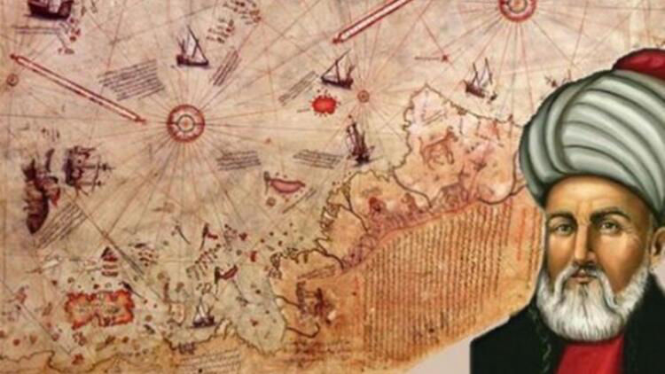
Piri Reis Source
In 1526 Piri Reis produced his "Bahriye", a famous illustrated sea atlas of the world. Here he mentioned Columbus' book again and suggested "on hearsay" that it was from classical times.
America was known of in classical times but documentary evidence is slim. The only pre-modern book that we know of concerning America is Inventio Fortunata. It was not well-known in Europe and probably unknown to the Turks. There is therefore, a strong possibility that the book Piri Reis mentioned was the Inventio Fortunata.
In 1956 a letter referring to the existence of the Inventio Fortunata was found in the Archivo General de Simancas (Spain). It was written in Spain during the winter of 1497–98 by the Bristol merchant John or Johan Day, alias Hugh Say of London (of whom much more later), to "The Most Magnificent And Most Worthy Lord - The Lord Grand Admiral". John Day writes, "...Your Lordship's servant brought me your letter. I have seen its contents and I would be most desirous and most happy to serve you. I do not find the book Inventio Fortunata, and I thought that I (or he) was bringing it with my things, and I am very sorry not [to] find it because I wanted very much to serve you. I am sending the other book of Marco Polo and a copy of the land which has been found [by John Cabot (Newfoundland)]…" The letter also contains a great deal of detailed information regarding John Cabot’s voyages of discovery.
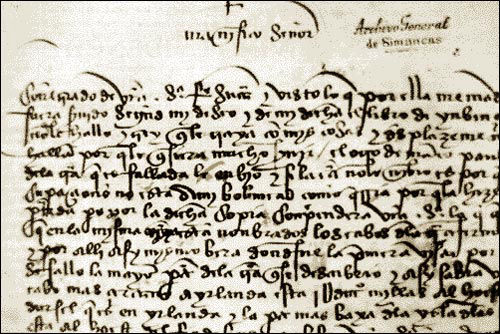
The John Day Letter Source
Curiously there is no date on the letter nor any clear indication as to exactly who it was written too. Most sources claim it was written to Columbus. On May 30, 1498, i.e. the spring following the letter, Columbus left Sanlúcar, Spain with six ships for his third trip to the New World. He was accompanied by Bartolomé de Las Casas. We can assume that they were also accompanied by the Inventio Fortunata as it seems that it went with them on all of Columbus’ voyages, which makes it very odd that the ‘Lord Grand Admiral’ would be asking this John Day character to get him a copy.
John or Johan Day, or rather Hugh Say of Bristol, was a member of England’s Merchant Company [The Merchant Adventurers], which was even more powerful than Bristol’s local Society of Merchant Adventurers; they controlled all of England’s textile industry. The same organisation later sponsored the Pilgrims on the Mayflower.
The English formed the largest ex-patriot merchant community in Seville’s port of Sanlúcar de Barrameda (Cadíz), after the Genoese. Day was associated with the di Nigri family who employed Columbus in the 1470s. The internet stubbornly refuses to yield any information on this family. In 1470 he was in Savona, Italy. The first confirmed record of Columbus being at sea is also dated to 1470 when he was hired to serve on the Genoese warship of René d’Anjou.
John Day/Hugh Say did business with Francisco Pinelo, the Genoese royal Treasurer of Castile, and Pinelo’s nephew, Barnardo Pinelo, the treasurer of the Indies enterprise in Seville. Say was related by marriage to Lord Mountjoy, Henry VII’s Master of the Mint. In 1494, he was granted membership in the Bristol staple as “John Day of London, merchant.” Say was also related by marriage to some of the Bristol merchants who sponsored Cabot, and with Icelandic merchants in Bristol [maybe one and the same]. His family supported the Yorkists against Henry VII (in spite of his brother-in-law being the King's Master of the Mint,) which may explain his alias. He wasn’t a very nice person, judging by two Chancery petitions taken out against him for what amounts to fraud c. 1502. Source
So this unsavoury character, was incredibly well connected with all of the various elements involved in the rediscovery of the New World. It seems reasonable to assume that if he owned or was able to get a copy of the Inventio Fortunata, that John Cabot also used it for his voyages. In fact, it could be that the Inventio Fortunata was the source and inspiration for all of the so-called voyages of discovery to the New World during the Middle Ages.
It should be noted that all of the earliest descriptions of the Far North speak of a whirlpool or whirlpools that control the world’s tides:
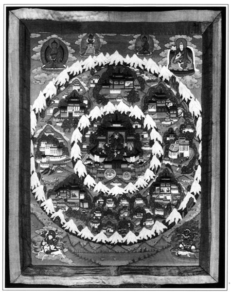
Shambala Source
Traditions of a paradisaical, primeval land in the far north are universal. Often this sacred land is said to be located in the 'centre' or 'navel' of the earth. The northern paradise is also associated with a mountain, pillar or a tree from which four rivers emerge.
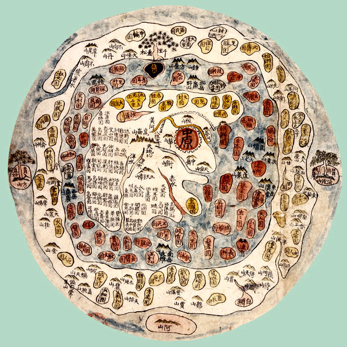
A Korean world map from the mid 1300s centred on Mount Meru.
(Wikipedia insists that this mountain is legendary and in Asia) Source
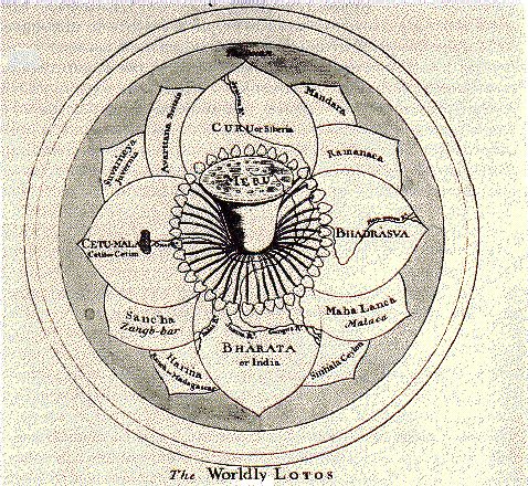
Theosophy: The first continent, the Imperishable Sacred Land, surrounded and included the north pole and extended somewhat southwards from the pole in seven different zones, like the leaves of a lotus. These zones included Greenland, Spitzbergen, Sweden, Norway, and Siberia, together with other former land areas in the far north that have since been submerged. The central locality of the first continent was right at the north pole.
From The Secret Doctrine:
“Oriental tradition is ever referring to an unknown glacial, gloomy sea, and to a dark region, within which, nevertheless, are situated the Fortunate Islands, wherein bubbles, from the beginning of life on earth, the fountain of life. But the legend asserts, moreover, that a portion of the first dry island (continent), having detached itself from the main body, has remained, since then, beyond the mountains of Koh-Kaf, 'the stony girdle that surrounds the world.' A journey of seven months' duration will bring him who is possessed of 'Sulayman's ring' to that 'fountain,' if he keeps on journeying North straight before him as the bird flies. Journeying therefore from Persia straight north, will bring one along the sixtieth degree of longitude, holding to the west, to Novaya Zemlya; and from the Caucasus to the eternal ice beyond the Arctic circle would land one between 60 and 45 degrees of longitude, or between Novaya Zemlya and Spitzbergen.
“Nevertheless, the wandering songsters of Persia and the Caucasus will maintain, to this day, that far beyond the snow-capped summits of Kap, or Caucasus, there is a great continent now concealed from all.”
Like the Egyptians and the Akkadians, the Indians conceived of two opposed polar mounts: the arctic Meru, known as Sumeru (su = good, beautiful), was the dwelling of the gods, and the Antarctic Meru, or Kumeru (ku = bad, miserable), was the dwelling of the demons.
Aryvarsha, home of the Vedas Source
The Avestan (Zoroastrian) term 'Airyanem Vaejah' (Pahlavi: Eran-Vej) designates the cradleland, located not in any of the earth's seven climates, but at the centre of the central zone, the eighth climate. It was there that Yima, the 'first man', received the command to construct a vara, or enclosure, where the most highly developed humans, animals, and plants would be gathered in order to save them from the deadly winter unleashed by the demonic powers so that they might one day refurbish a transfigured world.
The Flatearther, Isidor of Seville (c. 630) said, "There lies another continent besides the three known ones, beyond the ocean, far up north, and there the sun is warmer than anywhere in our country [Spain]." (Etymologies, Bk. 14, Chapter 5).
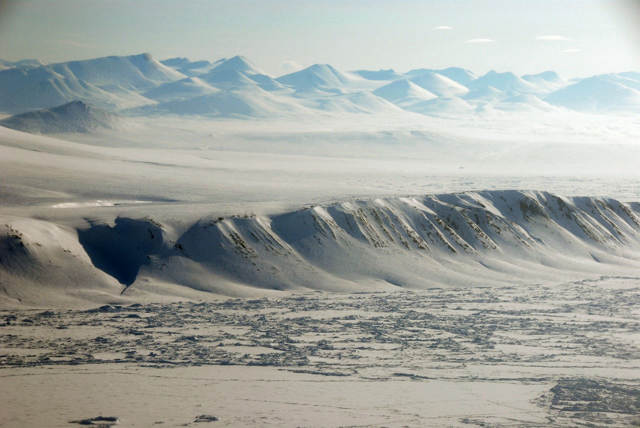
Ellesmere Island Source
In 1721 Greenland was resettled, but the original Viking colonists had disappeared. The Eskimos claimed that they had migrated further and further north, until one day a hunting party returned saying they had discovered a paradise in the north - a place the Eskimos had always known about, but generally stayed away from because they believed it to be inhabited by evil spirits. However, the Vikings all promptly packed their bags, and singing songs, departed happily northward out over the ice and never returned.
In Greenland animals should migrate South for the winter, but in fact they all migrate North, and Northern winds in Greenland are actually warmer than Southern winds during winter. Early arctic explorers inferred that they were heading to a warm land in the north.
In 1904 Dr R.A. Harris of the US Coast and Geodetic Survey published an article explaining why he believed that there must be a large body of undiscovered land or shallow water in the polar basin northwest of Greenland.
Eskimos living on the northern fringes of the Arctic Ocean had a tradition that a landmass existed to the north. Out over the ice towards the northwest of Greenland ...is a land that is warm; is clothed in summer verdure the year around; is populated by fat caribou and musk-ox. It lies," they say even to this day, "in the direction of the coastal trail-route north." (December 1923 issue of Popular Science Monthly)
Phantom Islands of the Arctic Source
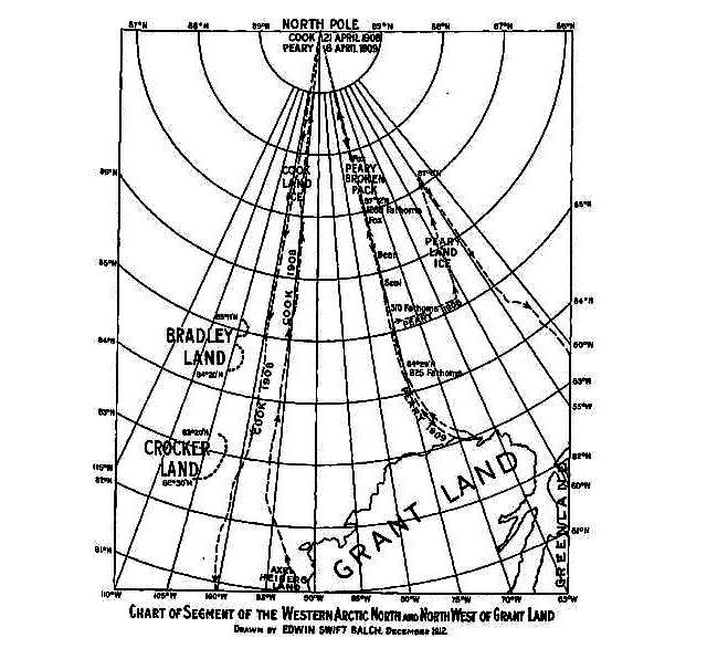
Land has been sighted out over the Arctic wastes by several different explorers from different directions at different times. It is a land that has been sighted always in the same direction, whether seen from Greenland, Alaska or northern Russia. The Russians called it Sannikov land and have seen it north of the New Siberian Islands. Admiral Peary on his way to the pole in 1909 sighted land northwest of Cape Thomas Hubbard on the northwest coast of Ellesmere Island in Northern Canada. With him, Lt. Green, MacMillan and their Eskimos also saw it and even later went on an expedition out on the ice to find it and only turned back when their Eskimos claimed it only to be a mist. MacMillan swore it looked every bit like real land.
Admiral Peary did also and he named it Crocker Land. Dr. Cook on his way to the pole in 1906 saw it also towards the northwest of his trek to the pole from Ellesmere Island and even took a picture of it. He named it Bradley Land. Then from Harrison Bay on the north coast of Alaska, Captain Keenan sighted land also towards the northwest.
Bradley Land Source
Bradley Land Source
The Norwegian arctic explorer, Dr. Fridtjof Nansen, in his book, Farthest North, relates his observations of several anomalous phenomena on his Arctic expedition of 1893-94 in the ship, the Fram. To their surprise out on the ice pack, they found a remarkable number of birds of various kinds including snipe and seagulls, also foxes, walrus and polar bears that indicated they were in the proximity of land towards the north. While waiting out the winter, they took scientific measurements and observations. They found rock and large quantities of mud and driftwood on some of the icebergs that indicated to Nansen that much of the Arctic ice originates in a river, perhaps further to the north than they were then located - in some uncharted land.
‘Muck’ - a dark soil containing decomposed animal and vegetable matter - is a major geological mystery. It covers one-seventh of the earth's land surface and all of it surrounds the Arctic Ocean. Muck occupies treeless, generally flat terrain, with no surrounding mountains from which the muck could have eroded. Russian geologists have in some places drilled through 4,000 feet (1220 m ) of muck without hitting solid rock. Where did so much eroded material come from?
“Though the ground is frozen for 1,900 feet (579 m) down from the surface at Prudhoe Bay [Alaska], everywhere the oil companies drilled around this area they discovered an ancient tropical forest. It was in frozen state, not in petrified state. It is between 1,100 (335 m) and 1,700 feet (518 m) down. There are palm trees, pine trees, and tropical foliage in great profusion. In fact, they found them lapped all over each other, just as though they had fallen in that position." (Lindsey Williams, The Energy Non-Crisis, 2nd. Edition, 1980, p. 54).
The Kolma River in SiberiaMammoth ’fossils’ and forest
debris are washed up here - even fresh plums! Source
“Siberian fossil ivory [F: this is a misnomer, as anything fossilised is turned to stone] forms the principal material on which the Russian ivory-turner works. The best tusks are found in the countries near the Arctic circle and in the most eastern regions. The first discovery of these curious remains was made in 1799 by a Tungusian, named Schumachoff who had embarked to seek along the coasts for mammoth tusks and spotted a huge shapeless mass in the ice. The entire skeleton of this strange animal is now in the Museum at St. Petersburg, and a part of the.skin and some of the hair are deposited in the Museum of the Royal College of Surgeons. The existence of the mammoth has been traced to a period so recent, that it no doubt approached nearly to, if it has not existed contemporaneously with, man. In what manner, and by what strange convulsion of nature, these animals were destroyed in the freezing latitudes of the Arctic circle, has never been explained, and will probably ever remain a mystery.” (Routledge's guide to the Crystal Palace and park at Sydenham - G. Routledge & Co. (1854))
An Allegedly Real Live Mammoth Source
The remains of woolly rhino, steppe lions, giant deer, mammoth, foxes and a hardy breed of horse have all been found flash-frozen in the Arctic.
"Frozen-food experts have pointed out that to do this, starting with a healthy, live specimen, you must drop the temperature of the air surrounding it down to a point well below minus 150 degrees Fahrenheit (-101 C)" Ivan T. Sanderson, "Riddle of the Frozen Giants," Saturday Evening Post, Jan. 16, 1960, pp. 82-83
"To deep freeze a huge living mammoth, insulated in thick fur...stupendously cold temperatures of below -101 degrees C. (-150 degrees F.) would be required. Such temperatures have never been recorded -- not even in the Arctic." The article goes on: "Apparently, at one moment the mammoth was munching away peacefully at the grass and butter-cups growing lush in the sunshine of a temperate plain. The next it was subjected to cold so bitter that it was deep frozen where it stood." Many of the frozen mammoths have been found in a standing position, surrounded by frozen silt. Their body tissues and stomach contents had not even begun to decompose." The Readers' Digest Book of Strange Stories and Amazing Facts
Scotland - no trees Source
The Caledonian Forest is the name given to the former (ancient old-growth) temperate rainforest of Scotland. Most of Scotland used to be covered in forest. Today, native woodland covers just 4% of the total land area. In Scotland, ancient woodland is defined as land that is currently wooded and has been continually wooded since at least 1750. In 1900, only about 5% of Scotland’s land area was wooded. Source
The usual Climate Change excuse is offered: “The forest declined over thousands of years, due to both a slow change to a wetter, windier climate and to being felled by man and overgrazed by sheep and most especially deer.” Source
Another explanation put forward is that all of the trees were used for shipbuilding during the Middle Ages. A similar situation exists in Iceland, famous for its total lack of shipbuilding, where the forest is missing presumed dead. You decide...
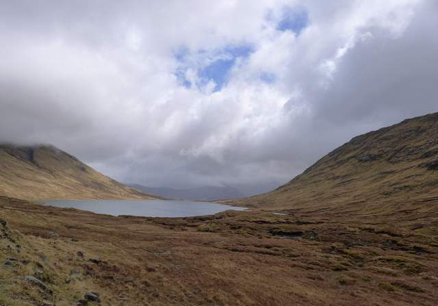
It would appear from The Four Ancient Books of Wales, or the Mabinogi, that the northern part of the British Isles was considered to be a barren wilderness full of supernatural activity and not the place for a weekend break. Procopius, the 6th century Greek historian and author of the ‘Secret History’, described this northern wilderness:
"In this isle of Britain men of ancient time built a long wall, cutting off a great portion of it, for the soil and the men, and all other things, are not alike on both sides; for on the eastern [southern] side of the wall there is a wholesomeness of air, in conformity with the seasons, moderately warm in summer and cool in winter. Many men inhabit here, living much as other men. The trees, with their appropriate fruits, flourish in season, and their corn-lands are as productive as others, and the district appears sufficiently fertilised by streams. But on the western [northern] side all is different, insomuch indeed that it would be impossible for man to live there even half-an-hour. Vipers and serpents innumerable, with all other kinds of wild beasts, infest that place, and what is most strange, the natives affirm that if any one passing the wall should proceed to the other side, he would die immediately, unable to endure the unwholesomeness of the atmosphere. Death also, attacking such beasts as go thither, forthwith destroys them. But as I have arrived at this point of my history, it is incumbent on me to record a tradition very nearly allied to fable, which has never appeared to me true in all respects, though constantly spread abroad by men without number, who assert that themselves have been agents in the transaction, and also hearers of the words. I must not, however, pass it by altogether unnoticed, lest when thus writing concerning the island Brittia I should bring upon myself an imputation of ignorance of certain circumstances perpetually happening there. They say, then, that the souls of men departed are always conducted to this place."
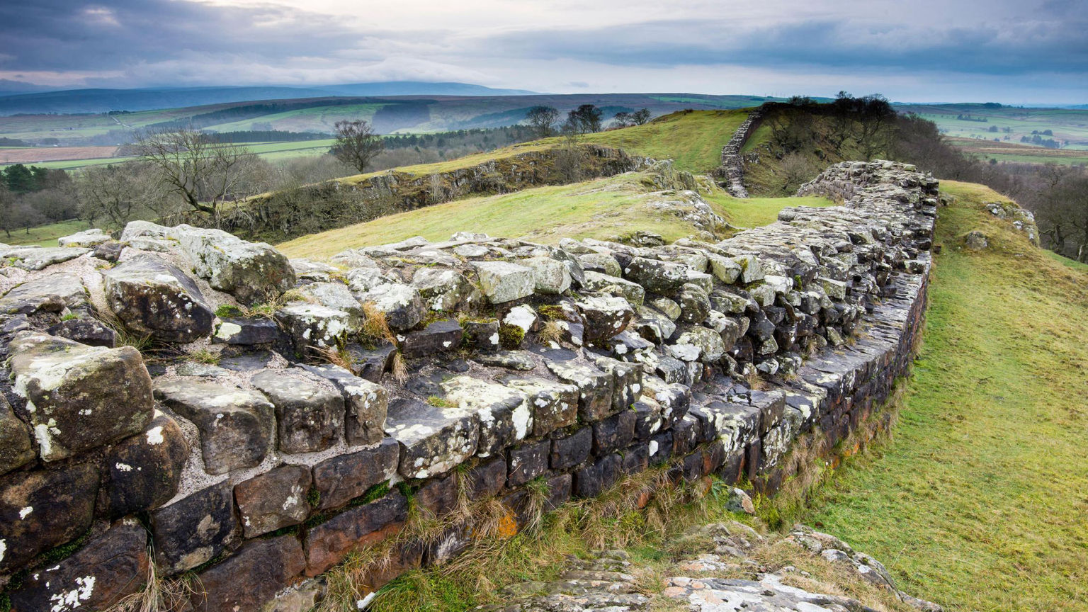
Hadrian’s Wall, Northern England Source
Tibetan sacred texts prophesies that a future king of Shambhala will come with a great army to free the world from barbarism and tyranny and will usher in a golden age. Similarly, the Hindu Puranas say that a future world redeemer – the Kalki-Avatara, the tenth and final manifestation of Vishnu – will come from Aryavarsha to end the 'Kali Yuga' era.
There are many such legends from all over the world that tell of heroes who will return to right the wrongs of the world. Even Jesus can be included amongst them. In the case of Arthur and the Buddhist and Vedic prophesies, these heroes are connected with the North Pole. Of all of the racial memories, archetypes, call them what you will, why have these been remembered so universally? Surely this indicates a common ancient source.
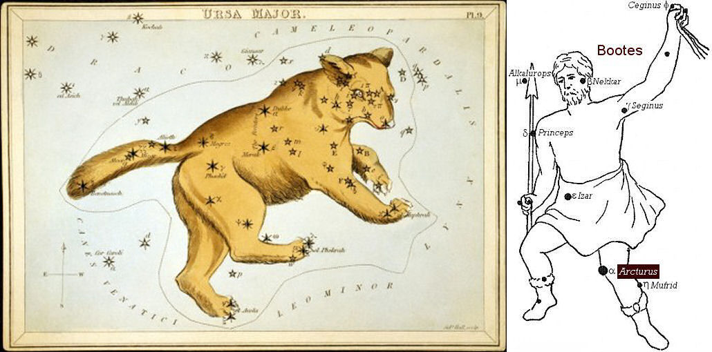
The Bear (Ursa Major) and Arcturus in the Bootes Constellation Source
Arcturus is the 4th brightest star in the heavens and located in the northern constellation of Bootes. “The name Arcturus is derived from the Greek Αρκτοῦρος (Arktouros) or ἄρκτος (arktos) and οὖρος (ouros), meaning “Bear Watcher” or “Guardian of the Bear,” referring to the bear represented by the neighbouring constellation Ursa Major.” (Source) These two constellations perpetually circle the North Pole. Arthur has long been associated with Arcturus and also the Bear.
If civilisation was once centred around the North Pole, as so many legends and scriptures relate and the climate there was mild, even tropical, then it would appear that from this starting point it spread southwards – which is of course in all directions away from north. Alongside all of the many ‘polar paradise’ traditions mentioned above, there is also a similar corpus of legends relating to a worldwide network of tunnels and even a subterranean realm with entrances in the North Pole that lead right across the earth. Many races claim that they ‘appeared’ on the surface from underground. Some of these tunnels have been discovered, particularly in South America. The North Polar source seems to have always been regarded as the spiritual home though.
In the familiar ‘lost civilisation’ myths and legends, such as Atlantis, Lemuria, El Dorado etc., it seems there must always be a tragedy whereby the civilisation is brought to the point of extinction. The Hyperborean tradition is no different in that respect.
From what little as been revealed by the Inventio Fortunata and the Gestis Arthuri, whatever cataclysm took place must have happened after King Arthur’s expedition to the North Polar islands. He was able to sit out a whole winter in Scotland with his army. The islands and places around the pole described by the Inventio Fortunata are not covered in frozen ice… and that bloody Minorite Monk wouldn’t have lasted 5 minutes with no shoes!
The only reason for Arthur’s mission that we are made aware of is simply conquest and colonisation. However, that was John Dee’s agenda and not necessarily Arthur’s. The legend of Arthur as a uniting hero and champion of justice, whilst echoed in some far flung places, has its nucleus in Europe, especially northern Europe. At the time we are speaking of, it must have been a very different place with the British Isles joined to mainland Europe via Lyonesse and Doggerland. What could prompt such a character to intervene in such a decisive manner in the affairs of mankind’s spiritual home in the North Pole? Nothing good, that’s for sure.
If we make the assumption that ‘Avalon’ at the North Pole was the cradle of civilisation, then we can safely assume that the cities captured and colonised in the mountains around the pole were already established before Arthur arrived. This further presents the possibility that he was recapturing them and recolonising them. Logically it follows that someone or something had invaded the area and taken control. This heroic saga would be recorded and reflected out from the centre to the rest of the worldwide civilisation and this would explain why the same basic ‘myth’ is encountered in many different places.
If we add the poem Preiddeu Annwfn into the mix we can perhaps catch a glimpse of what occurred. The Guardianship of Annwn or Avalon had somehow fallen into untrustworthy hands who were no longer in control. This resulted in catastrophic changes whereby there was a prolonged period of darkness and cold which threatened the very fabric of life on Earth. King Arthur’s mission to the North Pole was to regain control of Annwn or Avalon, which he seems to have done successfully, but at great cost. Judging by Taliesin’s parting shots in the poem, it could well be that ‘monks’ or the new Christian religion had some involvement in the loss of control over Avalon. It would also appear that the ‘big freeze’ was already afoot and unstoppable.
We will never know how long Arthur’s victory lasted as clearly some catastrophic event took place whereby areas of the Arctic Circle were covered in up to 4,000 feet of 'muck' and then instantly flash-frozen. This seems to have affected areas as far south as Scotland and must have been a world changing event.
In another poem from The Book of Taliesin, called ‘Angar Kyfyndawt’ (‘The Hostile Confederacy’), Annwfyn or Avalon is unusually described as being below the earth:
“In Annwfyn the peacefulness,
In Annwfyn the wrath,
In Annwfyn below the earth,”
If the configuration of the North Pole and the tidal whirlpool is accurate, then so much 'muck' deposited on top of it would have totally disrupted the world’s tides and caused major flooding. Presumably, (although not impossibly) the Muck Deluge did not discriminate between land and sea, therefore the addition of so much bulk to the seas and the landmasses in the north must have affected sea levels and worldwide topography to a great extent. This ‘flood’ also survives as a universally shared memory or legend.
These topics are greatly enlarged upon in the newer series: The Dark Earth Chronicles
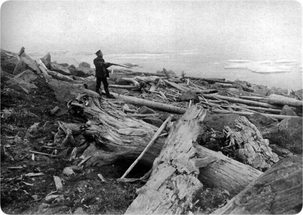
‘Fossil' forest debris washed up on the New Siberian Islands.
Soldiers with guns(?) Source
If we can manage to salvage some credibility from the tale of Jacobo Cnoyen and his encounter in Norway, it seems that Arthur and his Polar Colony survived. The dates assigned to this meeting are obviously completely wrong, but it does coincide with the Arthurian legend whereby Arthur finally went to Avalon and he is still there, waiting for the time when he will be needed to come and save us once again. This concept is also reflected throughout many different cultures, particularly the Vedas – which come from Aryavarsha, the land around Mount Meru at the North Pole. Maybe all that’s required to bring him forth is enough belief that he will come.
Kalki-Avatara Source
Antarctica is a massive subject, too big to include in this article – which is quite big enough. It also involves the contentious issue of flat vs. globe earth. (Personally, I don’t know what shape the Earth is, all I do know is it isn’t a spinning globe). However, in my opinion, the Arctic Deluge and the Flash-Freeze took place at the same time that Antarctica froze over – it was all part of the same event.
My source for the following information has been lost over the years. It can’t be found in the written Vedas, but it did appear to be reliable. However, please feel free to ignore it. The 'ring' or border of frozen water around the Earth plane was known as Antarika in Sanskrit, which predates the name 'Antarctica' by many many years. This word translates as "what lies in between" and this ring isolates us from everything else for the duration of the 'Kali Yuga' period.
Checkout this Wikiwaki link. The word ‘Antarika’ is used to refer to Antarctica in a Croatian sentence, but the word doesn’t translate…?
Antarika seems to be the Indonesian word for Antarctica. Really strange photo here.
Miscellaneous sources used for this article:
Felix Noille & Will Scarlet
.
IF YOU ARE SEEING A LINK TO MOBIRISE, OR SOME NONSENSE ABOUT A FREE AI WEBSITE BUILDER, THEN IT IS A FRAUDULENT INSERTION BY THE PROVIDERS OF THE SUPPOSEDLY 'FREE' WEBSITE SOFTWARE USED TO CREATE THIS SITE. THEY ARE USING MY WEBHOSTING PLATFORM FOR THEIR OWN ADVERTISING PURPOSES WITHOUT MY CONSENT. TO REMOVE THESE LINKS I WOULD HAVE TO PAY A YEARLY FEE TO MOBIRISE ON TOP OF MY NORMAL WEBHOSTING EXPENSES - WHICH IS TANTAMOUNT TO BLACKMAIL. I CALCULATE THAT THEY CURRENTLY OWE ME THREE MILLION DOLLARS IN ADVERTISING REVENUE AND WEBSITE RENTAL.